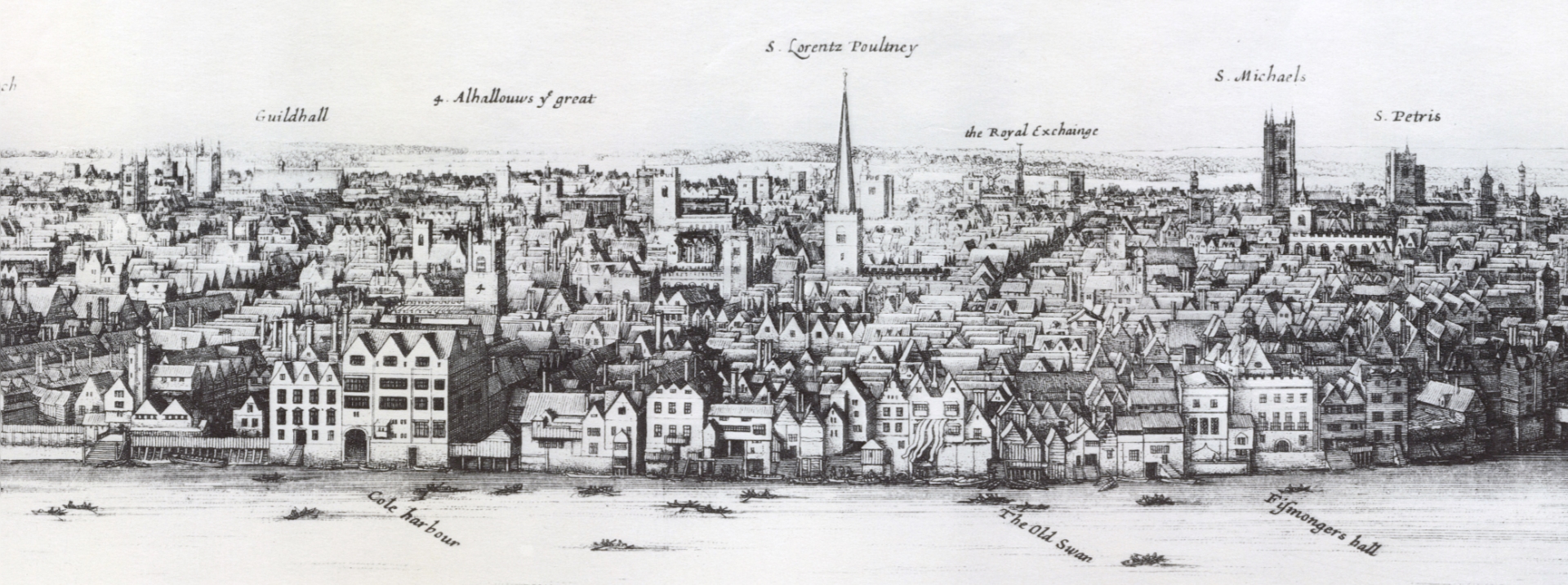
Example: 3D City Scene 1647 - Wenceslaus Hollar
draft topic outline following taken from standalone linkedin article, re-write required
Wenceslaus Hollar 1607-1677 was a prolific engraver of the mid 17th century. He produced may cityscapes, including the engraving of London shown below.
 London From Bankside - 1647 Wenceslaus Hollar [Public domain], via Wikimedia
 Detail: London From Bankside - 1647 Wenceslaus Hollar [Public domain], via Wikimedia
The River Thames carves through the scene, anchoring the rest of it. London Bridge crosses the Thames in a similar position today. The former St Paul's Cathedral and the Tower of London allow us to understand its situation relative to our times.
We may not include quite so many angels floating on clouds but this is a 3D scene, a direct ancestor of our 3D products. The intent is to communicate the geography of London and show where things are situated relative to each other. Prominent landmarks are identified, labeled and numbered in much the same way that we may label features on our maps.
It is hard for us to imagine how much work must have gone into producing such a work, from the initial sketches through to the engraving of the plates. We have the luxury of ever better data and tools that allow us to build 3D scenes, view, share and publish these for public use.
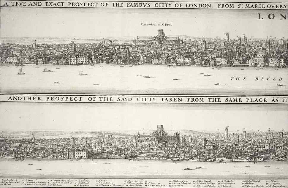
 London before and after the fire - C1670 - Wenceslas Hollar [Public Domain] via Wikimedia
Twenty years after his earlier work, the Great Fire of London consumed the heart of the city, changing it forever. Holler used the cityscape to great effect, documenting London before and after the fire, showing the extent of the destruction. He uses the two views to illustrate change in the same way that we may now allow users to toggle between a before and after view of a new development to understand changes to the urban environments.
We are rediscovering the power of the cityscape and how it can be used as a communication tool. Our 3D scenes can be manipulated with relative ease, we can change our point of view as we navigate through the city or landscape. The browser makes it easy to publish our models for viewing by a wide audience, allowing the public to explore their urban environment and understand changes.
3D GIS is a compelling way of visualising our urban environment. We have tools and data available to us that Holler and others could not have even dreamed about.
(Wikipedia - Wenceslaus Hollar)[https://en.wikipedia.org/wiki/Wenceslaus_Hollar]